UAV How-To: Create a Forage Canopy Model with Photogrammetry
AEN-146
UAV How-To: Create a Forage Canopy Model with Photogrammetry
UAV How-To: Create a Forage Canopy Model with Photogrammetry
Authored by: Joe Dvorak Joshua Jackson Cameron Minch Tucker Sheffield
Abstract
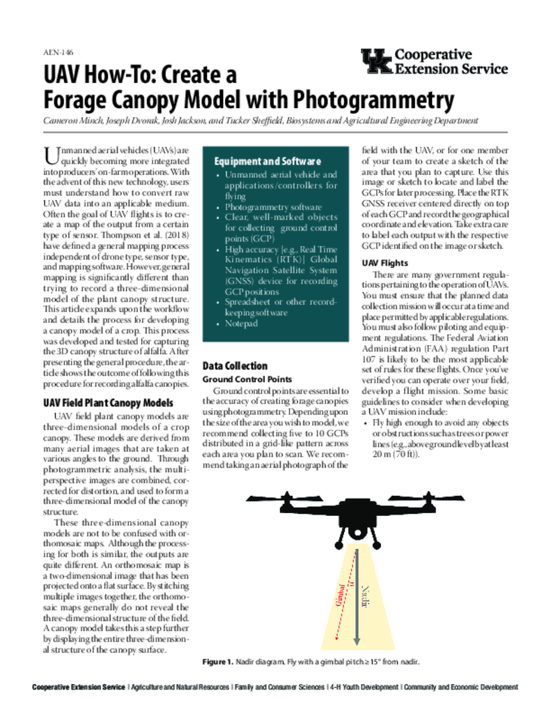
Unmanned aerial vehicles (UAVs) are quickly becoming more integrated into producers' on-farm operations. With the advent of this new technology, users must understand how to convert raw UAV data into an applicable medium. Often the goal of UAV flights is to create a map of the output from a certain type of sensor. Thompson et al. (2018) have defined a general mapping process independent of drone type, sensor type, and mapping software. However, general mapping is significantly different than trying to record a three-dimensional model of the plant canopy structure. This article expands upon the workflow and details the process for developing a canopy model of a crop.
Core Details
Categorical Details
Language
English
Peer Reviewed?
Yes
